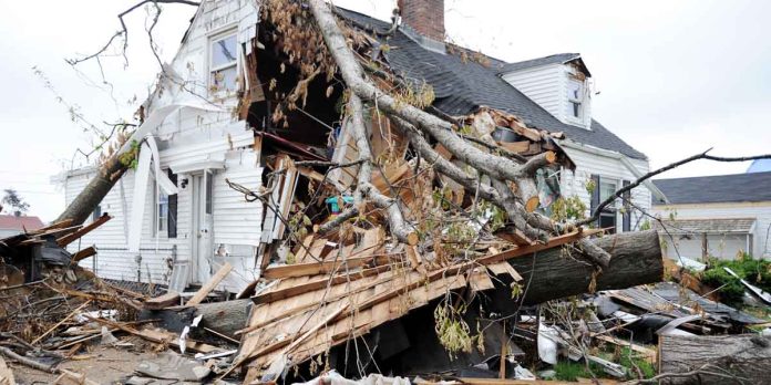
Nearly 7 million people live in Massachusetts. Many of these people have experienced natural disasters in the state firsthand or had to evacuate because of disasters. However, many Massachusetts residents don’t realize how many types of natural disasters can occur.
This analysis covers what natural disasters occur in Massachusetts, the worst natural disasters to hit the state since 2000, and what residents can do to prepare.
Is Massachusetts At Risk of Natural Disasters?
Compared to the rest of the United States, Massachusetts has a very low risk of natural disasters. Excluding COVID, Massachusetts has had 31 disaster declarations since 2000. Of these, 17 were declared major disasters.
Massachusetts is also sometimes hit by natural disasters, which cause more than $1 billion in damages. Since 2000, more than 19 separate $1-billion events have affected the state.
Worst Natural Disasters in Massachusetts By Cost (Since 2000)
- Hurricane Sandy 2012: $83.9 billion
- Hurricane Ida 2021: $80.2 billion
- Hurricane Irene 2011: $17.7 billion
- Hurricane Isaias 2020: $5.5 billion
- 2016 Drought: $4.3 billion
Worst Natural Disasters in Massachusetts By Deaths (Since 2000)
- Hurricane Sandy 2012: 159 deaths
- Hurricane Ida 2021: 96 deaths
- Hurricane Irene 2011: 45 deaths
- Groundhog Day Blizzard 2011: 36 deaths
- April 2020 Tornado Outbreak: 35 deaths
*Cost and death tolls are for the entire disaster, including in other states affected.
Most Common Natural Disasters in Massachusetts
1. Flooding
Massachusetts is very high risk when it comes to flooding. The coastal areas are particularly vulnerable to storm surges and tidal flooding from sea level rise and tropical cyclones.
Inland parts of Massachusetts are also at risk of flooding from snow melt and intense rains. Heavy rains can also cause deadly flash floods in Massachusetts.
Massachusetts Flood Stats:
- 21% of residential land in towns and cities is in a 100 or 500-year floodplain
- 79 cities and towns in MA have MEMA coastal storm surge zones
- 193,300 properties at substantial risk in 2020
- 88,000 FEMA flood damage claims since 2000
- 336,200 properties at risk by 2050
- 215,400 properties will be at substantial risk by 2050
- 46,800 properties at almost certain risk by 2050
Which Areas of Massachusetts Are Most At-Risk to Flooding?
Floods can occur in all parts of Massachusetts, but some areas of the state are particularly at-risk. Below are the areas of Massachusetts which have the greatest percentage of properties which were likely to experience flooding (based on 2020 calculations).
- Hull: 65%
- Ocean Bluff-Brant Rock: 54%
- Adams: 48%
- Salisbury: 44%
- Provincetown: 40%
- Lawrence: 38%
- Winthrop Town: 35%
Because of climate change, the risk of flooding is growing in many parts of Massachusetts. For example, 23% of properties in Cambridge are at risk of flooding, but this number will increase to 43% by 2050.
There are also thousands of properties in major Massachusetts cities at risk. In Boston, over 19,000 properties are currently at risk. In Worcester, over 5,400 properties are at risk.
Worst Flood Events in Massachusett’s Recent History
Hurricane sandy in 2012 was one of the worst floods in recent Massachusetts history. The hurricane caused 2.5 to 4.5 feet of storm surge along the eastern coast and widespread flooding. More than 8,000 properties were affected.
The floods of March 2010 are also amongst the worst. More than 70 inches of rain fell in less than 48 hours, causing widespread flooding and an estimated $75 million in damages. Other states in the Northeast were also affected, causing a total of $2.5 billion in damages and 11 fatalities.
In addition to these major events, Massachusetts has also had many smaller flood events. It doesn’t take much flood water to cause massive property damage, so residents must know the risks and be prepared.
2. Heavy Snow and Winter Storms
Massachusetts Winter Weather Stats:
- Average snowfall per year: 51”
- Snowfall days per year: 53 days
- Coldest recorded temperature: -35°F in Chester in 1981
- Record snowfall: 29” in Natick on April 1st, 1997
Massachusetts ranks #8 in the country for the most snowfall and #12 for the most snowfall days yearly. The western half of Massachusetts gets much more snowfall than other areas, averaging 77 inches per year.
Snowfall in Massachusetts often comes down as snowstorms or blizzards. These winter storms can shut down businesses and travel, resulting in huge economic losses. Since 2000, the state has been affected by five billion-dollar winter storms.
3. Freezing Rains
The climate of the Northeast makes it ideal for freezing rain. Most areas of Massachusetts can expect at least 12 hours of freezing rain each year. Some areas receive 18-21 hours per year. This makes it one of the most at-risk states in the USA for freezing rain.
Freezing rain most frequently occurs during December and January, but fall and spring freeze events also occur.
Icy road conditions from the rain make vehicle accidents and personal injuries common. It’s also common for people to lose power during freezing rain events, meaning that thousands can be left without a way to heat their homes during the coldest months.
4. Hurricanes
Massachusetts doesn’t experience hurricanes as frequently as coastal states in the South. However, from 1851 to 2020, Massachusetts was hit by 12 hurricanes. Of these, seven were Category 1, and four were Category 2 hurricanes.
Because Massachusetts is so densely populated, hurricanes can cause massive damage. In 2022, the state ranked #17 for expected hurricane property and population losses per capita in the country.
5. Heat Waves
As with the rest of the country, the risk of heat days is increasing in Massachusetts. Currently, Massachusetts has almost no “dangerous” heat days per year. The National Weather Service defines these as days where the heat index is 103F or above. By 2050, the number of dangerous heat days in Massachusetts is expected to increase to 10 per year.
In addition to more dangerous heat days, Massachusetts will see more “Local Hot Days.” Local Hot Days are defined as
“Days at or above the 98th percentile temperature, or the temperature than an area could expect to see on the hottest 7 days of the year.”
Essentially, Local Hot Days factor in what temperatures a local population is used to experiencing.
An increase in Local Hot Days is associated with health problems like strokes, and heat-related deaths are more likely to occur. Energy demands also increase from air conditioning use.
All parts of Massachusetts are expected to have an increase in Local Hot Days, but Nantucket County is particularly at-risk. By 2053, Nantucket is expected to have 21 consecutive days with temperatures at or above 82.7℉.
6. Wildfires
A large portion of Massachusetts is covered in forests. However, it is a wet state with lots of rainfall, so wildfires are uncommon. When wildfires do occur, they are usually small and quickly contained.
Because of climate change, though, the risk of wildfires in Massachusetts is growing. By 2050, an estimated 26% of all properties in the state will be at risk of wildfire.
Massachusetts Wildfire Stats:
- Acres burned in 2021: 1,439
- Number of fires in 2021: 588
- Percentage of state covered by forests: 60%
- Number of properties currently at risk of wildfire: 618,735


